New Marston Meadows
See also Almonds Farm Fields and Burnt Mill Meadow LWS, Old Marston
Thomas Langdon's 1605 maps of Old Marston Meadows
with Judy's notes on their history (see info pane beside Alan Jones's sketch map - 2nd image) are available here
Oxford University Park Farm
includes the Park Farm farmhouse and land that belonged to the farm.
Flooding photos by Marilyn Cox
06 01 2024 05 01 2024 02 02 2021 23 03 2020 15 11 2019 11 01 2014 13 01 2014
04 and 05 01 2024 by Roddy Bray 28 11 2012 by Judy Webb
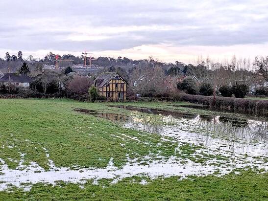
Looking towards The Old Barn, Edgeway Road, by Roddy Bray - 5 January 2024
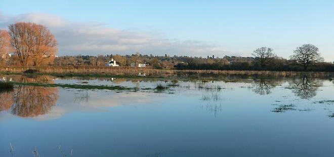
New Marston Meadows, 6 January 2024, taken from path to Rainbow Bridge inaccessible on 5th - Marilyn Cox
Below: New Marston Meadows, 2 February 2021 - Marilyn Cox
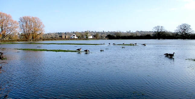
Flooding in New Marston Meadows, 2 February 2021
Scroll down for general information, maps and Judy Webb's report (2011) prepared
for the Rare Plants Group of the Ashmolean Natural History Society of Oxfordshire
Slideshow of photos of New Marston Meadows, with explanatory captions, prepared by Judy in 2010
|
New Marston Meadows, adjacent to the Cherwell river in Oxford, are an important green link between the SAC meadows of Yarnton West Mead and Pixey Mead to the north-west and Magdalen and Iffley Meadows to the south.
New Marston Meadows SSSI (designated 1993) contains 44.42 ha of fields that were designated either as good examples of lowland neutral grassland, NVC (National Vegetation Classification) community MG4, Meadow Foxtail – Great Burnet (Alopecurus pratensis-Sanguisorba offininalis) flood meadow or as variants of a valuable, more swampy, meadow or grazed-meadow type, and one on slightly higher ground, which is a drier community most similar to NVC community MG5, Crested Dog’s-tail – Knapweed (Cynosurus cristatus – Centaurea nigra) 11 plants on the Rare Plants Register for Oxfordshire are found in the meadows adjacent to the Cherwell River within the New Marston Meadows SSSI boundaries. A further three species on the register are found in meadows outside the SSSI but within a Local Wildlife Site. The information above was taken from a Report by Judy Webb on New Marston Meadows - 25 May 2011 for the Oxfordshire Flora Group of the Ashmolean Natural History Society of Oxfordshire and the New Marston Wildlife Group (dissolved 30 March 2015, now Friends of Milham Ford Nature Park).
|
See also New Marston Meadows page of website for
Friends of Milham Ford Nature Park Judy Webb's map of public paths and info on the meadows New Marston Meadows history and further information History of surveying and management of New Marston Meadows, by Judy Webb, 30 April 2017; this includes a link to Thomas Langdon's 1605 maps of the area at the end. 'A story of flowers, floods and friends', an article posted by Kirsty B. (5 Oct 2014 ) on the RSPB's Farming blog about the New Marston SSSI and local farmer Mr Blackburn, much of whose farm was within it. (Park Farm is now owned by Oxford University.) Judy is mentioned - she sent Kirsty her records for the site. 'How to manage hedges to maximise their benefits for people and farms' - a leaflet by Rob Wolton, posted by Hedgelink. The photo by Judy is of meadow 50B of New Marston Meadows, taken on 28 November 2012. Photos of Drinker Moth and caterpillar taken by Judy Webb & Christopher Hoskin - Almond's Farm Meadow, 2015 |
Photos below taken in New Marston Meadows August/September 2015 by Judy Webb
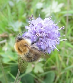
Common Carder Bee (Bombus pascuorum) on Devil's Bit Scabious
|
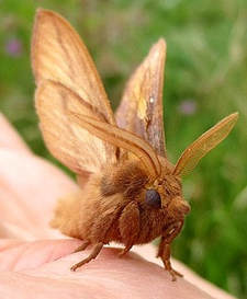
Male Drinker Moth (Euthrix potatoria)
Almond's Farm meadow
|
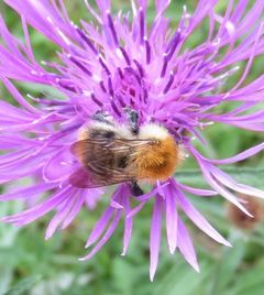
Common Carder Bee (Bombus pascuorum) on Knapweed
|
