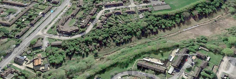
Above is a snip from Google Maps (2017) showing the Lye Valley North fen running from The Slade towards the Oxford Golf Club (NE to SW). The brown-coloured area is the North Fen SSSI, where reed that had been cut had not yet grown back when this photo was taken. Regular reed-cutting by volunteers is essential to prevent the reed choking the wildflowers. The stream bank in this area has been reinforced by volunteers. Willow trees that were causing too much shade have been pollarded.
Judy's sketch map (2017) showing the Lye Valley North Fen
Further along the valley is the South Fen, which is the area of land clear of trees, roughly forming a triangle and brown in colour, seen on Google Maps below the tree-covered area next to Lye Valley road and with both its southern sides adjacent to the golf course. At the bottom of the 'V' formed by Lye Valley road and Town Furze is a pair of semi-detached houses with open green land to the west of them: this land, directly adjacent to the South Fen, was the subject of an unsuccessful planning application (see 'Land West of 75 Town Furze' on Lye Valley Planning Applications page). Another Google Maps aerial view shows the proximity of the Churchill Hospital, illustrating why this beautiful area is so popular with hospital staff as a quiet place for lunchtime relaxation.
Map showing location of the Lye Valley SSSI In the North Fen (adjacent to The Churchill Hospital) brown shading within the green-lined area indicates inclusion in Natural England's Lowland Fens Priority Habitat Inventory for England. To the south, another area of green parallel lines marks the South Fen SSSI (adjacent to golf course).
